


Fontfreyde_Cheire_Mercoeur

jagarnier
User GUIDE
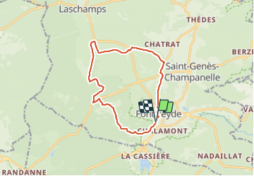

Length
12.1 km

Max alt
977 m

Uphill gradient
265 m
Km-Effort
15.6 km

Min alt
835 m

Downhill gradient
265 m
Boucle
Yes
Creation date :
2018-11-11 09:51:05.978
Updated on :
2025-07-03 07:42:19.494
3h45
Difficulty : Medium

FREE GPS app for hiking
 SityTrail
IGN / Geographical institutes
SityTrail Plus
The world is yours!
About
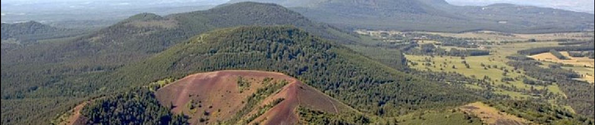
Trail Walking of 12.1 km to be discovered at Auvergne-Rhône-Alpes, Puy-de-Dôme, Saint-Genès-Champanelle. This trail is proposed by jagarnier.
Photos

Positioning
Country:
France
Region :
Auvergne-Rhône-Alpes
Department/Province :
Puy-de-Dôme
Municipality :
Saint-Genès-Champanelle
Location:
Unknown
Start:(Dec)
Start:(UTM)
500207 ; 5060946 (31T) N.
Comments