Trail Walking Fréjus - z l'Estarpe 13-11-18 - Photo
 cb8310
cb8310

User

© OpenStreetMap contributors
Length
Length
6.6 km
Max alt
Max alt
385 m
Uphill gradient
Uphill gradient
124 m
Km-Effort
Km-Effort  
8.2 km
Min alt
Min alt
280 m
Downhill gradient
Downhill gradient
124 m
Boucle
Boucle
Yes
Creation date :
2018-11-13 13:55:48.506
Updated on :
2018-11-14 09:35:03.745

(1 Reviews)

Walking
Walking
1h51
Difficulty : Easy

Scan this QR Code to open this trail in the SityTrail application

FREE GPS app for hiking

Logo SityTrail SityTrail

IGN / Geographical institutes

Download SityTrail from the App Store Download SityTrail from Google Play

Logo SityTrail SityTrail World

The world is yours!

Download SityTrail from the App Store Download SityTrail from Google Play Download SityTrail on Huawei AppGallery

About

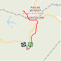
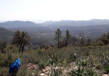
Trail Walking of 6.6 km to be discovered at Provence-Alpes-Côte d'Azur, Var, Fréjus. This trail is proposed by cb8310.

Description

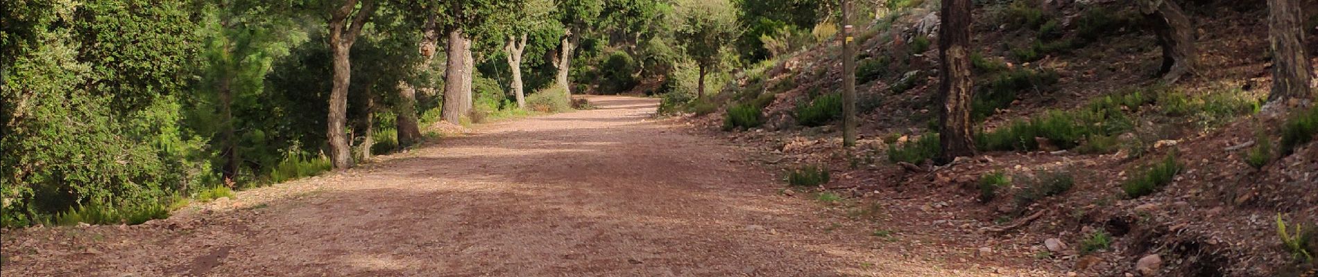
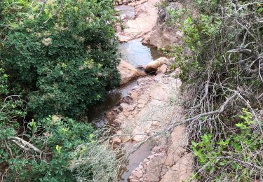
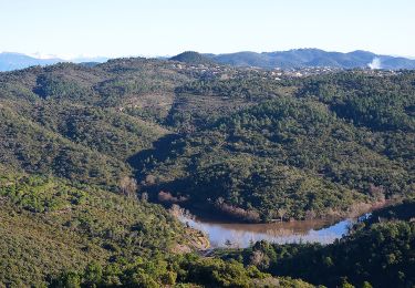
Larges pistes encore détrempées par endroit,sous un soleil enfin revenu,nous a permis de randonner de la Maison du Malpey au Logis de Paris en découvrant les merveilles de la nature avec ses arbres aux feuilles rougissantes
rando sans difficultés

Elevation profile

Photos

Positioning

Country:
France
Region :
Provence-Alpes-Côte d'Azur
Department/Province :
Var
Municipality :
Fréjus
Location:
Unknown
Start:(UTM)
322568 ; 4818388 (32T) N.

Comments

Please log in to post a review or rate the element


Trails nearby

Trail Walking Saint-Raphaël - Les lacs par les rochers du Caneiret - Photo
Walking
ETMU5496

Walking

Medium
(1)
Saint-Raphaël, Provence-Alpes-Côte d'Azur, Var, France
20 km | 29 km-effort
5h 7min
Yes
Trail Walking Fréjus - Lac de l'Avelan au départ du col d'Auriasque - Photo
Walking
LtZIP

Walking

Easy
(2)
Fréjus, Provence-Alpes-Côte d'Azur, Var, France
16.6 km | 23 km-effort
5h 39min
Yes
Trail Walking Fréjus - Plan d'Esterel - mont Vinaigre - tour des Malavalettes - Photo
Walking
SabetMick

Walking

Medium
(1)
Fréjus, Provence-Alpes-Côte d'Azur, Var, France
15.4 km | 22 km-effort
5h 22min
Yes
Trail Mountain bike Fréjus - grand tour esterel par belles pistes larges - Photo
Mountain bike
Margaide

Mountain bike

Easy
(2)
Fréjus, Provence-Alpes-Côte d'Azur, Var, France
31 km | 40 km-effort
3h 17min
Yes
Trail Walking Saint-Raphaël - Agay - Sainte-Barbe - Étang des Nénuphares - Photo
Walking
E.BURCK

Walking

Easy
(2)
Saint-Raphaël, Provence-Alpes-Côte d'Azur, Var, France
5 km | 6.2 km-effort
2h 8min
Yes
Trail Walking Fréjus - Mont Vinaigre par Colle Douce - Photo
Walking

Walking

Very difficult
(1)
Fréjus, Provence-Alpes-Côte d'Azur, Var, France
22 km | 33 km-effort
6h 1min
Yes
Trail Walking Fréjus - barage du malpasser - Photo
Walking
pierro06

Walking

Very easy
(1)
Fréjus, Provence-Alpes-Côte d'Azur, Var, France
5.1 km | 7.6 km-effort
1h 55min
Yes
Trail Walking Fréjus - Plan d'Estérel - Mont Vinaigre - Photo
Walking
tracegps

Walking

Medium
(1)
Fréjus, Provence-Alpes-Côte d'Azur, Var, France
15.6 km | 22 km-effort
4h 0min
Yes
Trail Walking Fréjus - Mont Vinaigre - Photo
Walking
i20

Walking

Easy
(1)
Fréjus, Provence-Alpes-Côte d'Azur, Var, France
7.8 km | 11.9 km-effort
Unknown
Yes


Close
My subscriptions