


La Dent de Vaulion
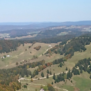
Les Monts du Jura
Saint Maur Rando, la rando pour tous
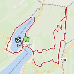

Length
14.6 km

Max alt
1470 m

Uphill gradient
526 m
Km-Effort
22 km

Min alt
1001 m

Downhill gradient
528 m
Boucle
Yes
Creation date :
2018-12-02 09:46:24.883
Updated on :
2019-01-06 13:10:53.742
4h31
Difficulty : Medium

FREE GPS app for hiking
 SityTrail
IGN / Geographical institutes
SityTrail Plus
The world is yours!
About
Trail Walking of 14.6 km to be discovered at Vaud, District du Jura-Nord vaudois, L'Abbaye. This trail is proposed by Les Monts du Jura.
Positioning
Country:
Switzerland
Region :
Vaud
Department/Province :
District du Jura-Nord vaudois
Municipality :
L'Abbaye
Location:
Unknown
Start:(Dec)
Start:(UTM)
295356 ; 5171765 (32T) N.
Comments