


Eguilles - les Brulades - le Mazet

mhetpierre
User
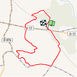

Length
9.7 km

Max alt
276 m

Uphill gradient
124 m
Km-Effort
11.4 km

Min alt
193 m

Downhill gradient
124 m
Boucle
Yes
Creation date :
2018-12-07 10:06:49.157
Updated on :
2018-12-10 18:16:20.291
2h12
Difficulty : Very easy

FREE GPS app for hiking
 SityTrail
IGN / Geographical institutes
SityTrail Plus
The world is yours!
About
Trail Walking of 9.7 km to be discovered at Provence-Alpes-Côte d'Azur, Bouches-du-Rhône, Saint-Cannat. This trail is proposed by mhetpierre.
Positioning
Country:
France
Region :
Provence-Alpes-Côte d'Azur
Department/Province :
Bouches-du-Rhône
Municipality :
Saint-Cannat
Location:
Unknown
Start:(Dec)
Start:(UTM)
683741 ; 4828827 (31T) N.
Comments