


Col_Beal_Vallon_Fossat

jagarnier
User GUIDE
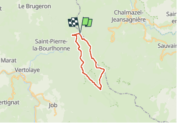

Length
16.9 km

Max alt
1609 m

Uphill gradient
574 m
Km-Effort
25 km

Min alt
1178 m

Downhill gradient
574 m
Boucle
Yes
Creation date :
2018-12-21 20:05:35.715
Updated on :
2024-02-07 06:23:11.362
5h15
Difficulty : Difficult

FREE GPS app for hiking
 SityTrail
IGN / Geographical institutes
SityTrail Plus
The world is yours!
About
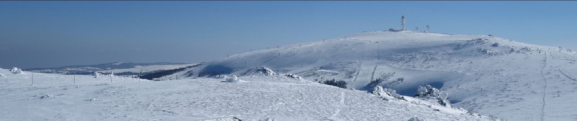
Trail Walking of 16.9 km to be discovered at Auvergne-Rhône-Alpes, Puy-de-Dôme, Saint-Pierre-la-Bourlhonne. This trail is proposed by jagarnier.
Photos

Positioning
Country:
France
Region :
Auvergne-Rhône-Alpes
Department/Province :
Puy-de-Dôme
Municipality :
Saint-Pierre-la-Bourlhonne
Location:
Unknown
Start:(Dec)
Start:(UTM)
560986 ; 5059387 (31T) N.
Comments