


Tour de Fogo

nave
User

Length
43 km

Max alt
594 m

Uphill gradient
1456 m
Km-Effort
63 km

Min alt
1 m

Downhill gradient
1423 m
Boucle
No
Creation date :
2018-12-22 12:35:56.635
Updated on :
2018-12-22 17:31:13.093
2h00
Difficulty : Very easy

FREE GPS app for hiking
 SityTrail
IGN / Geographical institutes
SityTrail Plus
The world is yours!
About
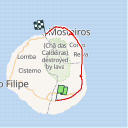
Trail Car of 43 km to be discovered at Unknown, Santa Catarina do Fogo. This trail is proposed by nave.
Description
Tour de Fogo
Photos


Positioning
Country:
Cape Verde
Region :
Unknown
Department/Province :
Santa Catarina do Fogo
Municipality :
Fonte Aleixo
Location:
Unknown
Start:(Dec)
Start:(UTM)
783486 ; 1643340 (26P) N.
Comments