


dans les gorges de Baudinard

bernir
User
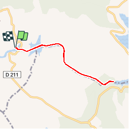

Length
6.8 km

Max alt
477 m

Uphill gradient
151 m
Km-Effort
8.8 km

Min alt
399 m

Downhill gradient
152 m
Boucle
Yes
Creation date :
2018-10-02 14:02:29.84
Updated on :
2018-12-26 19:21:29.597
--
Difficulty : Medium

FREE GPS app for hiking
 SityTrail
IGN / Geographical institutes
SityTrail Plus
The world is yours!
About
Trail Canoe - kayak of 6.8 km to be discovered at Provence-Alpes-Côte d'Azur, Alpes-de-Haute-Provence, Montagnac-Montpezat. This trail is proposed by bernir.
Positioning
Country:
France
Region :
Provence-Alpes-Côte d'Azur
Department/Province :
Alpes-de-Haute-Provence
Municipality :
Montagnac-Montpezat
Location:
Montpezat
Start:(Dec)
Start:(UTM)
266496 ; 4847694 (32T) N.
Comments