


Champier Les Effeuillers les étangs

bourset
User
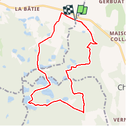

Length
9.3 km

Max alt
616 m

Uphill gradient
179 m
Km-Effort
11.7 km

Min alt
549 m

Downhill gradient
177 m
Boucle
Yes
Creation date :
2014-12-10 00:00:00.0
Updated on :
2014-12-10 00:00:00.0
2h26
Difficulty : Easy

FREE GPS app for hiking
 SityTrail
IGN / Geographical institutes
SityTrail Plus
The world is yours!
About
Trail Walking of 9.3 km to be discovered at Auvergne-Rhône-Alpes, Isère, Châtonnay. This trail is proposed by bourset.
Positioning
Country:
France
Region :
Auvergne-Rhône-Alpes
Department/Province :
Isère
Municipality :
Châtonnay
Location:
Unknown
Start:(Dec)
Start:(UTM)
677497 ; 5037875 (31T) N.
Comments
Bonne petite journée dans ce coin plein d'étangs.