


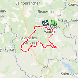
9464831-St Léger Vauban 22.86

togolo28
User

Length
23 km

Max alt
495 m

Uphill gradient
527 m
Km-Effort
30 km

Min alt
342 m

Downhill gradient
527 m
Boucle
Yes
Creation date :
2019-01-13 15:43:49.748
Updated on :
2019-01-14 11:25:55.224
--
Difficulty : Medium

FREE GPS app for hiking
 SityTrail
IGN / Geographical institutes
SityTrail Plus
The world is yours!
About
Trail On foot of 23 km to be discovered at Bourgogne-Franche-Comté, Yonne, Saint-Léger-Vauban. This trail is proposed by togolo28.
Description
Départ du village natal de Sébastien Le Prestre dit "Vauban'.
N'oubliez pas de visiter le Parc aux daims au cours de la randonnée.
Positioning
Country:
France
Region :
Bourgogne-Franche-Comté
Department/Province :
Yonne
Municipality :
Saint-Léger-Vauban
Location:
Unknown
Start:(Dec)
Start:(UTM)
579017 ; 5248546 (31T) N.
Comments