Trail Walking Chivres-Val - Autour du fort de Condé - Photo

Autour du fort de Condé

Randonnées de RandoFamili

© OpenStreetMap contributors
Length
Length
939 m
Max alt
Max alt
170 m
Uphill gradient
Uphill gradient
4 m
Km-Effort
Km-Effort  
999 m
Min alt
Min alt
165 m
Downhill gradient
Downhill gradient
6 m
Boucle
Boucle
Yes
Creation date :
2014-12-10 00:00:00.0
Updated on :
2014-12-10 00:00:00.0

(0 Reviews)

Walking
Walking
--
Difficulty : Unknown

Scan this QR Code to open this trail in the SityTrail application

FREE GPS app for hiking

Logo SityTrail SityTrail

IGN / Geographical institutes

Download SityTrail from the App Store Download SityTrail from Google Play

Logo SityTrail SityTrail World

The world is yours!

Download SityTrail from the App Store Download SityTrail from Google Play Download SityTrail on Huawei AppGallery

About

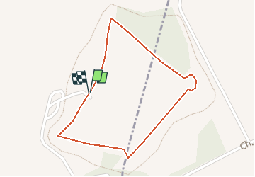
Trail Walking of 939 m to be discovered at Hauts-de-France, Aisne, Chivres-Val. This trail is proposed by Rando Famili.

Description

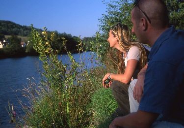
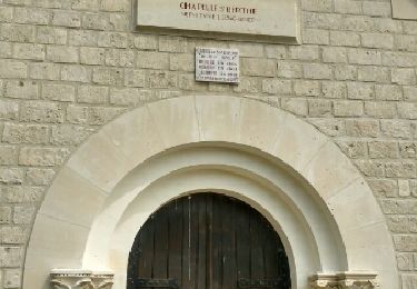
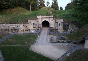
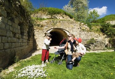
Ce circuit d'interprétation vous permettra de découvrir l'extérieur du Fort de Condé, un bel exemple de l'architecture militaire de la fin du XIXe siècle. Il offre un joli panorama sur les vallées de l'Aisne et de la Vesle. Une belle balade à faire en famille.

Elevation profile

Photos

Points of interest

Point of interest Chivres-Val - Fort de Condé : le pont levis - Photo
Rando Famili
Point of interest Condé-sur-Aisne - Fort de Condé : la double caponnière - Photo
Rando Famili
Point of interest Chivres-Val - Chambres d'hôtes de Chivres-Val - Photo
Rando Famili

Positioning

Country:
France
Region :
Hauts-de-France
Department/Province :
Aisne
Municipality :
Chivres-Val
Location:
Unknown
Start:(Dec)
Start:(UTM)
532953 ; 5472176 (31U) N.

Trails nearby

Trail Walking Venizel - Les rives de la vallée - Photo
Walking
tracegps

Walking

Medium
(1)
Venizel, Hauts-de-France, Aisne, France
10.8 km | 12 km-effort
2h 45min
Yes
Trail Walking Chivres-Val - Fort de condé - chivres - Photo
Walking
fitz2014

Walking

Very difficult
(1)
Chivres-Val, Hauts-de-France, Aisne, France
18 km | 22 km-effort
4h 48min
Yes
Trail Walking Aizy-Jouy - grand tour dans la foret derruere chez nous - Photo
Walking
Angele02

Walking

Medium
Aizy-Jouy, Hauts-de-France, Aisne, France
4.6 km | 6.1 km-effort
1h 44min
Yes
Trail Walking Aizy-Jouy - l assaut du chemin des dames - Photo
Walking
hm

Walking

Medium
Aizy-Jouy, Hauts-de-France, Aisne, France
12.4 km | 15.7 km-effort
2h 53min
Yes
Trail Walking Chivres-Val - 11 la fontaine St ouen - Photo
Walking
fitz2014

Walking

Medium
Chivres-Val, Hauts-de-France, Aisne, France
14.1 km | 17.5 km-effort
3h 53min
Yes
Trail Walking Bucy-le-Long - Détours et des tours - Photo
Walking

Walking

Very easy
Bucy-le-Long, Hauts-de-France, Aisne, France
7 km | 9 km-effort
Unknown
Yes
Trail Walking Chivres-Val - Chivres Val - La Fontaine de St Ouen - Photo
Walking
tracegps

Walking

Medium
Chivres-Val, Hauts-de-France, Aisne, France
12 km | 15.1 km-effort
4h 0min
No
Trail Walking Chassemy - Chassemy - Le temps perdu - Photo
Walking
tracegps

Walking

Medium
Chassemy, Hauts-de-France, Aisne, France
14.3 km | 17.5 km-effort
3h 45min
Yes
Trail Walking Vailly-sur-Aisne - Les roches de l'Abondin - Photo
Walking
tracegps

Walking

Very difficult
(1)
Vailly-sur-Aisne, Hauts-de-France, Aisne, France
9.8 km | 13.2 km-effort
3h 0min
Yes


Close
My subscriptions