Trail Walking Crèvecœur-sur-l'Escaut - Circuit des Mérovingiens - Photo

Randonnées de RandoFamili

© OpenStreetMap contributors
Length
Length
11.3 km
Max alt
Max alt
102 m
Uphill gradient
Uphill gradient
106 m
Km-Effort
Km-Effort  
12.7 km
Min alt
Min alt
61 m
Downhill gradient
Downhill gradient
107 m
Boucle
Boucle
Yes
Creation date :
2014-12-10 00:00:00.0
Updated on :
2014-12-10 00:00:00.0

(1 Reviews)

Walking
Walking
--
Difficulty : Unknown

Scan this QR Code to open this trail in the SityTrail application

FREE GPS app for hiking

Logo SityTrail SityTrail

IGN / Geographical institutes

Download SityTrail from the App Store Download SityTrail from Google Play

Logo SityTrail SityTrail World

The world is yours!

Download SityTrail from the App Store Download SityTrail from Google Play Download SityTrail on Huawei AppGallery

About

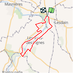
Trail Walking of 11.3 km to be discovered at Hauts-de-France, Nord, Crèvecœur-sur-l'Escaut. This trail is proposed by Rando Famili.

Description

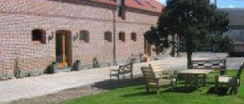
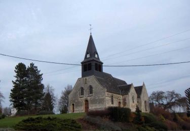
« Empreintes des moines et Belle de Vaucelles »
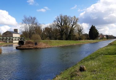
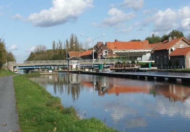
Pour remonter au temps des bâtisseurs, rien de tel qu’une visite à l’Abbaye de Vaucelles. L’Archéosite des-Rues-des-Vignes vous mènera jusqu’aux époques Gallo-romaine, Mérovingienne et Carolingienne ! Et si vous remontiez le cours du canal et ses écluses ?

Elevation profile

Photos

Points of interest

Point of interest Les Rues-des-Vignes - FR - Echauguette - randofamili - Photo
Rando Famili
LES RUES-DES-VIGNES 
Point of interest Les Rues-des-Vignes - FERME DE MONTECOUVEZ - Photo
Rando Famili
LES RUES-DES-VIGNES 
Point of interest Les Rues-des-Vignes - ABBAYE DE VAUCELLES - Photo
Rando Famili
LES RUES-DES-VIGNES 
Point of interest Les Rues-des-Vignes - FR - Abbaye de Vaucelles - Photo
Rando Famili
LES RUES-DES-VIGNES 
Point of interest Les Rues-des-Vignes - ARCHEO'SITE - Photo
Rando Famili
LES RUES-DES-VIGNES 
Point of interest Les Rues-des-Vignes - FR - Archeosite - randofamili - Photo
Rando Famili
LES RUES-DES-VIGNES 
Point of interest Crèvecœur-sur-l'Escaut - FERME DE MONTECOUVEZ - Photo
Rando Famili
CRÈVECŒUR-SUR-L'ESCAUT 

Positioning

Country:
France
Region :
Hauts-de-France
Department/Province :
Nord
Municipality :
Crèvecœur-sur-l'Escaut
Location:
Unknown
Start:(Dec)
Start:(UTM)
517852 ; 5550417 (31U) N.

Comments

Please log in to post a review or rate the element


randonnée facile et agreable sans trop de voitures


Trails nearby

Trail Walking Esnes - Du château d'Esnes à l'abbaye des Guillemins  -  Esnes    - Photo
Walking
tracegps

Walking

Medium
(1)
Esnes, Hauts-de-France, Nord, France
11.4 km | 13 km-effort
2h 49min
Yes
Trail Walking Les Rues-des-Vignes - Abbaye de Vaucelles - Photo
Walking
Greg813

Walking

Medium
Les Rues-des-Vignes, Hauts-de-France, Nord, France
22 km | 25 km-effort
5h 39min
Yes
Trail Walking Bantouzelle - Autour de l abbaye de Vaucelles - Photo
Walking
terminio

Walking

Easy
(1)
Bantouzelle, Hauts-de-France, Nord, France
6.6 km | 7.4 km-effort
1h 39min
Yes
Trail Walking Bantouzelle - Autour de l abbaye de Vaucelles - Photo
Walking
terminio

Walking

Easy
Bantouzelle, Hauts-de-France, Nord, France
6.6 km | 7.4 km-effort
1h 39min
Yes
Trail Walking Les Rues-des-Vignes - Saint Jacques en Boulangrie -  Abbayte de Vaucelles - Honnecourt sur Escaut  - Photo
Walking
tracegps

Walking

Medium
Les Rues-des-Vignes, Hauts-de-France, Nord, France
6.4 km | 6.8 km-effort
1h 30min
No
Trail Walking Crèvecœur-sur-l'Escaut - Circuit des mérovingiens  - Crèvecoeur sur l'Escaut - Photo
Walking
tracegps

Walking

Very difficult
Crèvecœur-sur-l'Escaut, Hauts-de-France, Nord, France
16.8 km | 19.2 km-effort
4h 10min
Yes
Trail Walking Rumilly-en-Cambrésis - Sentier du Val d'Escaut - Rumilly en Cambrésis - Photo
Walking
tracegps

Walking

Difficult
Rumilly-en-Cambrésis, Hauts-de-France, Nord, France
15.8 km | 17.3 km-effort
3h 55min
Yes
Trail Walking Noyelles-sur-Escaut - Circuit de l'Escauette - Noyelles sur Escaut - Photo
Walking
tracegps

Walking

Medium
Noyelles-sur-Escaut, Hauts-de-France, Nord, France
9 km | 9.8 km-effort
2h 15min
Yes
Trail Walking Les Rues-des-Vignes - Un détour par Honnecourt - Abbaye de Vaucelles - Photo
Walking
tracegps

Walking

Very difficult
(1)
Les Rues-des-Vignes, Hauts-de-France, Nord, France
18 km | 21 km-effort
6h 0min
Yes


Close
My subscriptions