


chartres-de-bretagne-sud

chasle
User
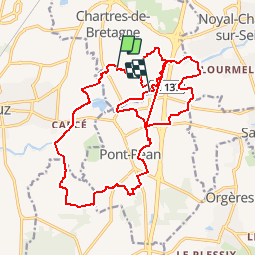

Length
23 km

Max alt
36 m

Uphill gradient
119 m
Km-Effort
25 km

Min alt
16 m

Downhill gradient
128 m
Boucle
No
Creation date :
2019-02-01 21:06:25.466
Updated on :
2019-02-01 21:06:25.466
--
Difficulty : Unknown

FREE GPS app for hiking
 SityTrail
IGN / Geographical institutes
SityTrail Plus
The world is yours!
About
Trail Walking of 23 km to be discovered at Brittany, Ille-et-Vilaine, Chartres-de-Bretagne. This trail is proposed by chasle.
Positioning
Country:
France
Region :
Brittany
Department/Province :
Ille-et-Vilaine
Municipality :
Chartres-de-Bretagne
Location:
Unknown
Start:(Dec)
Start:(UTM)
596415 ; 5320783 (30U) N.
Comments