


20190202!

Martinechampailler
User

Length
5.7 km

Max alt
429 m

Uphill gradient
112 m
Km-Effort
6.9 km

Min alt
336 m

Downhill gradient
48 m
Boucle
No
Creation date :
2019-02-02 17:11:10.657
Updated on :
2019-02-02 18:27:54.807
1h11
Difficulty : Very easy

FREE GPS app for hiking
 SityTrail
IGN / Geographical institutes
SityTrail Plus
The world is yours!
About
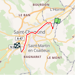
Trail Walking of 5.7 km to be discovered at Auvergne-Rhône-Alpes, Loire, Saint-Chamond. This trail is proposed by Martinechampailler.
Positioning
Country:
France
Region :
Auvergne-Rhône-Alpes
Department/Province :
Loire
Municipality :
Saint-Chamond
Location:
Unknown
Start:(Dec)
Start:(UTM)
620211 ; 5037246 (31T) N.
Comments