


Bourboule_Vendeix_Charlannes

jagarnier
User GUIDE
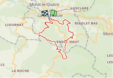

Length
15.4 km

Max alt
1259 m

Uphill gradient
750 m
Km-Effort
25 km

Min alt
860 m

Downhill gradient
749 m
Boucle
Yes
Creation date :
2019-02-05 09:01:52.596
Updated on :
2025-02-04 08:12:52.2
4h30
Difficulty : Difficult

FREE GPS app for hiking
 SityTrail
IGN / Geographical institutes
SityTrail Plus
The world is yours!
About
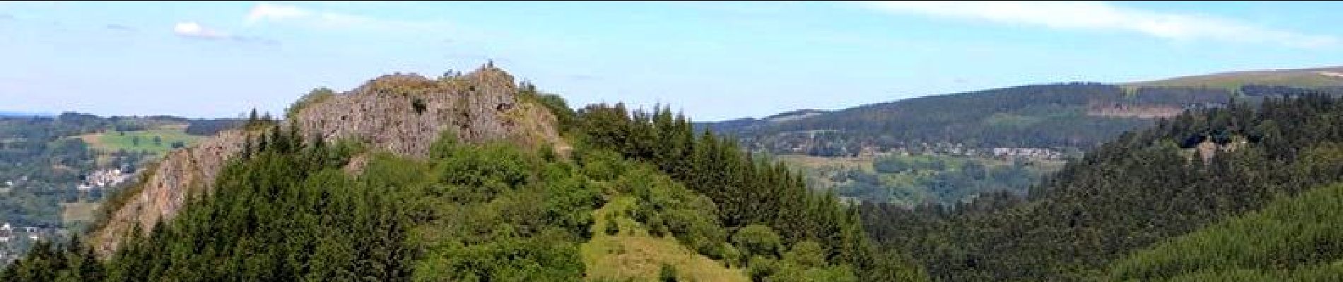
Trail Walking of 15.4 km to be discovered at Auvergne-Rhône-Alpes, Puy-de-Dôme, La Bourboule. This trail is proposed by jagarnier.
Photos

Positioning
Country:
France
Region :
Auvergne-Rhône-Alpes
Department/Province :
Puy-de-Dôme
Municipality :
La Bourboule
Location:
Unknown
Start:(Dec)
Start:(UTM)
479666 ; 5048030 (31T) N.
Comments