


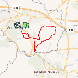
Ventabren - Camp de Marius - Roquefavour

mhetpierre
User

Length
11.7 km

Max alt
247 m

Uphill gradient
210 m
Km-Effort
14.6 km

Min alt
160 m

Downhill gradient
211 m
Boucle
Yes
Creation date :
2019-02-05 10:24:01.684
Updated on :
2019-02-14 19:29:07.072
3h19
Difficulty : Very easy

FREE GPS app for hiking
 SityTrail
IGN / Geographical institutes
SityTrail Plus
The world is yours!
About
Trail Walking of 11.7 km to be discovered at Provence-Alpes-Côte d'Azur, Bouches-du-Rhône, Ventabren. This trail is proposed by mhetpierre.
Positioning
Country:
France
Region :
Provence-Alpes-Côte d'Azur
Department/Province :
Bouches-du-Rhône
Municipality :
Ventabren
Location:
Unknown
Start:(Dec)
Start:(UTM)
685759 ; 4822768 (31T) N.
Comments