


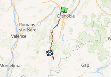
gr91-randonnee-de-st-nizier-du-moucherotte-isere-a-miscon-drome

chasle
User

Length
92 km

Max alt
1982 m

Uphill gradient
3802 m
Km-Effort
144 km

Min alt
558 m

Downhill gradient
4148 m
Boucle
No
Creation date :
2019-02-08 21:04:26.602
Updated on :
2019-02-08 21:04:26.602
--
Difficulty : Unknown

FREE GPS app for hiking
 SityTrail
IGN / Geographical institutes
SityTrail Plus
The world is yours!
About
Trail Walking of 92 km to be discovered at Auvergne-Rhône-Alpes, Isère, Saint-Nizier-du-Moucherotte. This trail is proposed by chasle.
Positioning
Country:
France
Region :
Auvergne-Rhône-Alpes
Department/Province :
Isère
Municipality :
Saint-Nizier-du-Moucherotte
Location:
Unknown
Start:(Dec)
Start:(UTM)
706732 ; 5005307 (31T) N.
Comments