


20190215 Descente Longet

motardes04
User

Length
4.3 km

Max alt
2705 m

Uphill gradient
0 m
Km-Effort
6.5 km

Min alt
2025 m

Downhill gradient
673 m
Boucle
No
Creation date :
2019-02-15 12:53:07.766
Updated on :
2019-02-15 14:17:07.29
1h23
Difficulty : Very easy

FREE GPS app for hiking
 SityTrail
IGN / Geographical institutes
SityTrail Plus
The world is yours!
About
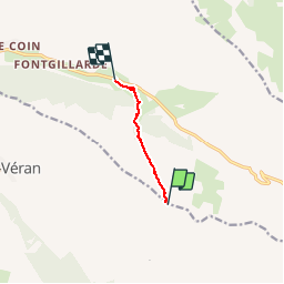
Trail Alpine skiing of 4.3 km to be discovered at Provence-Alpes-Côte d'Azur, Hautes-Alpes, Saint-Véran. This trail is proposed by motardes04.
Positioning
Country:
France
Region :
Provence-Alpes-Côte d'Azur
Department/Province :
Hautes-Alpes
Municipality :
Saint-Véran
Location:
Unknown
Start:(Dec)
Start:(UTM)
335231 ; 4950754 (32T) N.
Comments