


Alleins - Vernegues

mhetpierre
User
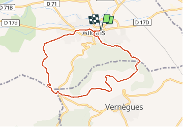

Length
9.1 km

Max alt
372 m

Uphill gradient
251 m
Km-Effort
12.5 km

Min alt
142 m

Downhill gradient
251 m
Boucle
Yes
Creation date :
2019-02-15 10:19:58.386
Updated on :
2019-02-15 21:26:33.663
3h12
Difficulty : Very easy

FREE GPS app for hiking
 SityTrail
IGN / Geographical institutes
SityTrail Plus
The world is yours!
About
Trail Walking of 9.1 km to be discovered at Provence-Alpes-Côte d'Azur, Bouches-du-Rhône, Alleins. This trail is proposed by mhetpierre.
Positioning
Country:
France
Region :
Provence-Alpes-Côte d'Azur
Department/Province :
Bouches-du-Rhône
Municipality :
Alleins
Location:
Unknown
Start:(Dec)
Start:(UTM)
674405 ; 4841329 (31T) N.
Comments