


Cervieres raquettes 4

kephas
User
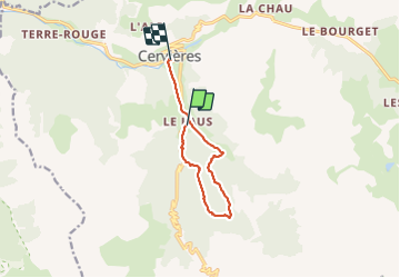

Length
9.1 km

Max alt
2301 m

Uphill gradient
551 m
Km-Effort
16.9 km

Min alt
1600 m

Downhill gradient
695 m
Boucle
No
Creation date :
2019-02-15 09:31:02.357
Updated on :
2019-02-15 19:01:56.527
7h47
Difficulty : Medium

FREE GPS app for hiking
 SityTrail
IGN / Geographical institutes
SityTrail Plus
The world is yours!
About
Trail Walking of 9.1 km to be discovered at Provence-Alpes-Côte d'Azur, Hautes-Alpes, Cervières. This trail is proposed by kephas.
Description
rando raquettes
Positioning
Country:
France
Region :
Provence-Alpes-Côte d'Azur
Department/Province :
Hautes-Alpes
Municipality :
Cervières
Location:
Unknown
Start:(Dec)
Start:(UTM)
320381 ; 4969290 (32T) N.
Comments