


petite camargue

NADINE52
User
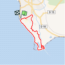

Length
7.1 km

Max alt
23 m

Uphill gradient
37 m
Km-Effort
7.6 km

Min alt
-1 m

Downhill gradient
37 m
Boucle
Yes
Creation date :
2019-02-16 11:10:50.182
Updated on :
2019-02-16 14:19:51.934
2h35
Difficulty : Very easy

FREE GPS app for hiking
 SityTrail
IGN / Geographical institutes
SityTrail Plus
The world is yours!
About
Trail Walking of 7.1 km to be discovered at Provence-Alpes-Côte d'Azur, Bouches-du-Rhône, Saint-Chamas. This trail is proposed by NADINE52.
Positioning
Country:
France
Region :
Provence-Alpes-Côte d'Azur
Department/Province :
Bouches-du-Rhône
Municipality :
Saint-Chamas
Location:
Unknown
Start:(Dec)
Start:(UTM)
664345 ; 4822459 (31T) N.
Comments