


volcan Fogo

PatriceCocuaud
User
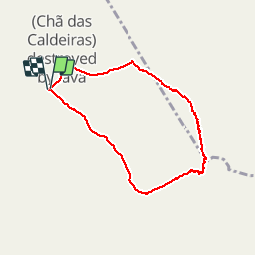

Length
9.9 km

Max alt
2792 m

Uphill gradient
1073 m
Km-Effort
24 km

Min alt
1712 m

Downhill gradient
1078 m
Boucle
Yes
Creation date :
2019-02-17 08:21:50.191
Updated on :
2019-02-17 21:18:25.402
3h34
Difficulty : Very easy

FREE GPS app for hiking
 SityTrail
IGN / Geographical institutes
SityTrail Plus
The world is yours!
About
Trail Walking of 9.9 km to be discovered at Unknown, Santa Catarina do Fogo. This trail is proposed by PatriceCocuaud.
Positioning
Country:
Cape Verde
Region :
Unknown
Department/Province :
Santa Catarina do Fogo
Municipality :
(Chã das Caldeiras) destroyed by lava
Location:
Unknown
Start:(Dec)
Start:(UTM)
783005 ; 1655898 (26P) N.
Comments