


Parent_Montpeyroux

jagarnier
User GUIDE
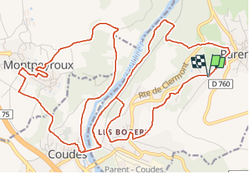

Length
9.8 km

Max alt
483 m

Uphill gradient
267 m
Km-Effort
13.4 km

Min alt
346 m

Downhill gradient
269 m
Boucle
Yes
Creation date :
2019-02-21 17:52:26.858
Updated on :
2025-08-04 05:21:56.499
3h00
Difficulty : Medium

FREE GPS app for hiking
 SityTrail
IGN / Geographical institutes
SityTrail Plus
The world is yours!
About
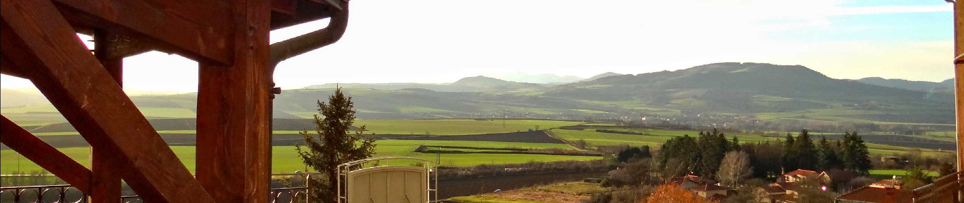
Trail Walking of 9.8 km to be discovered at Auvergne-Rhône-Alpes, Puy-de-Dôme, Parent. This trail is proposed by jagarnier.
Photos

Positioning
Country:
France
Region :
Auvergne-Rhône-Alpes
Department/Province :
Puy-de-Dôme
Municipality :
Parent
Location:
Unknown
Start:(Dec)
Start:(UTM)
517607 ; 5052017 (31T) N.
Comments
