


09072013retour

mikaelerouzic
User

Length
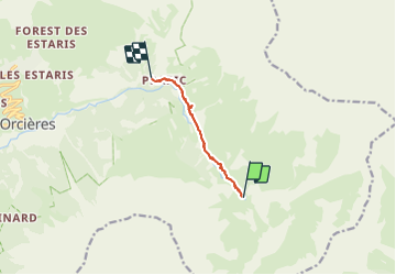
6.8 km

Max alt
1889 m

Uphill gradient
54 m
Km-Effort
8.7 km

Min alt
1533 m

Downhill gradient
405 m
Boucle
No
Creation date :
2014-12-10 00:00:00.0
Updated on :
2014-12-10 00:00:00.0
2h04
Difficulty : Easy

FREE GPS app for hiking
 SityTrail
IGN / Geographical institutes
SityTrail Plus
The world is yours!
About
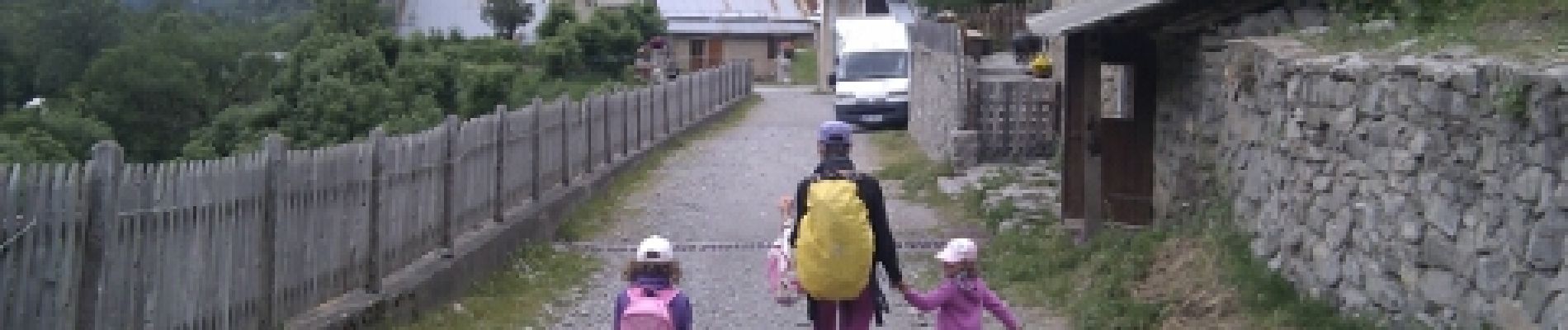
Trail Walking of 6.8 km to be discovered at Provence-Alpes-Côte d'Azur, Hautes-Alpes, Orcières. This trail is proposed by mikaelerouzic.
Photos

Positioning
Country:
France
Region :
Provence-Alpes-Côte d'Azur
Department/Province :
Hautes-Alpes
Municipality :
Orcières
Location:
Unknown
Start:(Dec)
Start:(UTM)
293453 ; 4949276 (32T) N.
Comments
bien mais pert le lien vers la carte ext..... je dois reparametrer !