


Dole-Besançon-Dole

albert39
User
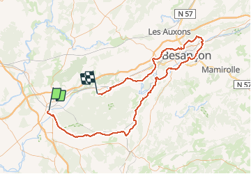

Length
128 km

Max alt
373 m

Uphill gradient
1502 m
Km-Effort
148 km

Min alt
194 m

Downhill gradient
1513 m
Boucle
No
Creation date :
2014-12-10 00:00:00.0
Updated on :
2014-12-10 00:00:00.0
6h15
Difficulty : Very difficult

FREE GPS app for hiking
 SityTrail
IGN / Geographical institutes
SityTrail Plus
The world is yours!
About
Trail Cycle of 128 km to be discovered at Bourgogne-Franche-Comté, Jura, Dole. This trail is proposed by albert39.
Description
Sortie RSGD (organisé par Jacques). Repas au cercle de la Gendarmerie. coupure batterie au retour sur Dole !
Positioning
Country:
France
Region :
Bourgogne-Franche-Comté
Department/Province :
Jura
Municipality :
Dole
Location:
Unknown
Start:(Dec)
Start:(UTM)
688417 ; 5218019 (31T) N.
Comments