


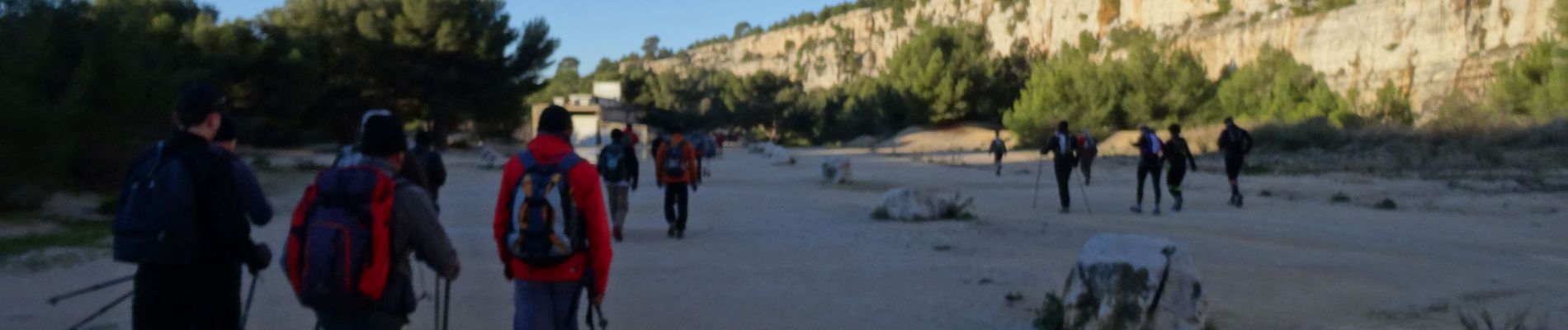
114ème Criterium des Calanques

donda
User GUIDE

Length
34 km

Max alt
428 m

Uphill gradient
1735 m
Km-Effort
58 km

Min alt
-5 m

Downhill gradient
1750 m
Boucle
No
Creation date :
2019-02-24 08:00:56.076
Updated on :
2019-02-26 05:55:44.712
9h00
Difficulty : Very difficult

FREE GPS app for hiking
 SityTrail
IGN / Geographical institutes
SityTrail Plus
The world is yours!
About
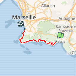
Trail Walking of 34 km to be discovered at Provence-Alpes-Côte d'Azur, Bouches-du-Rhône, Cassis. This trail is proposed by donda.
Photos


Positioning
Country:
France
Region :
Provence-Alpes-Côte d'Azur
Department/Province :
Bouches-du-Rhône
Municipality :
Cassis
Location:
Unknown
Start:(Dec)
Start:(UTM)
704842 ; 4787464 (31T) N.
Comments