


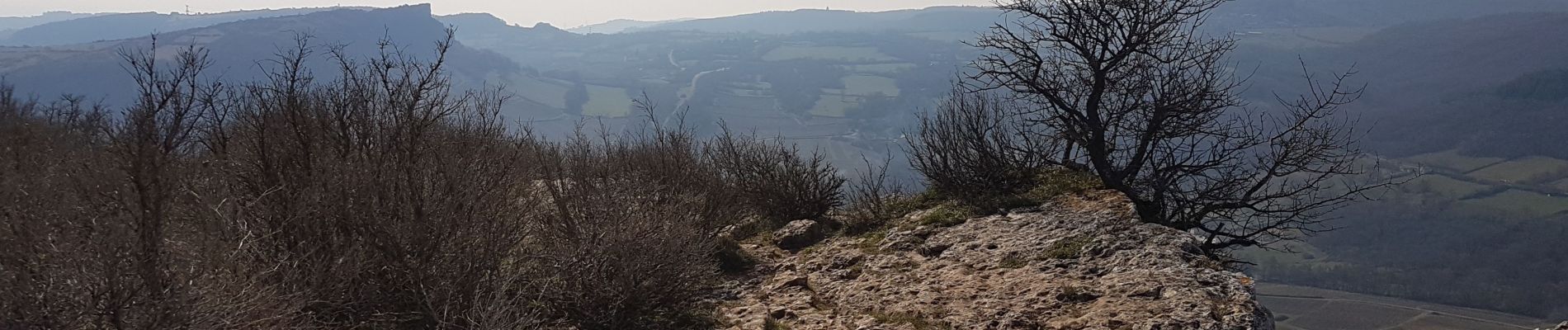
vergisson solutre de 2019

marchaisp
User
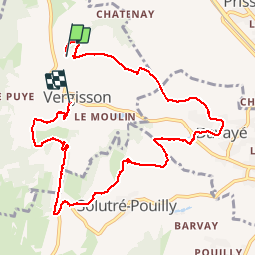

Length
9.9 km

Max alt
476 m

Uphill gradient
314 m
Km-Effort
14.4 km

Min alt
227 m

Downhill gradient
408 m
Boucle
No
Creation date :
2019-02-25 11:47:03.867
Updated on :
2019-02-25 15:52:13.666
3h06
Difficulty : Easy

FREE GPS app for hiking
 SityTrail
IGN / Geographical institutes
SityTrail Plus
The world is yours!
About
Trail Walking of 9.9 km to be discovered at Bourgogne-Franche-Comté, Saône-et-Loire, Vergisson. This trail is proposed by marchaisp.
Photos


Positioning
Country:
France
Region :
Bourgogne-Franche-Comté
Department/Province :
Saône-et-Loire
Municipality :
Vergisson
Location:
Unknown
Start:(Dec)
Start:(UTM)
631986 ; 5130437 (31T) N.
Comments