


RS-Sillans-Croix-de-Recandoux

raymondfn
User
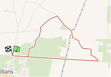

Length
4.9 km

Max alt
430 m

Uphill gradient
31 m
Km-Effort
5.3 km

Min alt
404 m

Downhill gradient
30 m
Boucle
Yes
Creation date :
2019-02-26 10:12:04.462
Updated on :
2022-01-20 15:51:32.49
1h10
Difficulty : Easy

FREE GPS app for hiking
 SityTrail
IGN / Geographical institutes
SityTrail Plus
The world is yours!
About
Trail Walking of 4.9 km to be discovered at Auvergne-Rhône-Alpes, Isère, Sillans. This trail is proposed by raymondfn.
Positioning
Country:
France
Region :
Auvergne-Rhône-Alpes
Department/Province :
Isère
Municipality :
Sillans
Location:
Unknown
Start:(Dec)
Start:(UTM)
687512 ; 5024197 (31T) N.
Comments