Trail Walking Saint-Symphorien-de-Lay - Saint Symphorien de Lay - Photo
 jpc42
jpc42

User

© OpenStreetMap contributors
Length
Length
12.1 km
Max alt
Max alt
577 m
Uphill gradient
Uphill gradient
353 m
Km-Effort
Km-Effort  
16.8 km
Min alt
Min alt
376 m
Downhill gradient
Downhill gradient
352 m
Boucle
Boucle
Yes
Creation date :
2019-02-26 13:36:52.687
Updated on :
2019-02-27 10:51:53.682

(0 Reviews)

Walking
Walking
3h20
Difficulty : Medium

Scan this QR Code to open this trail in the SityTrail application

FREE GPS app for hiking

Logo SityTrail SityTrail

IGN / Geographical institutes

Download SityTrail from the App Store Download SityTrail from Google Play

Logo SityTrail SityTrail World

The world is yours!

Download SityTrail from the App Store Download SityTrail from Google Play Download SityTrail on Huawei AppGallery

About

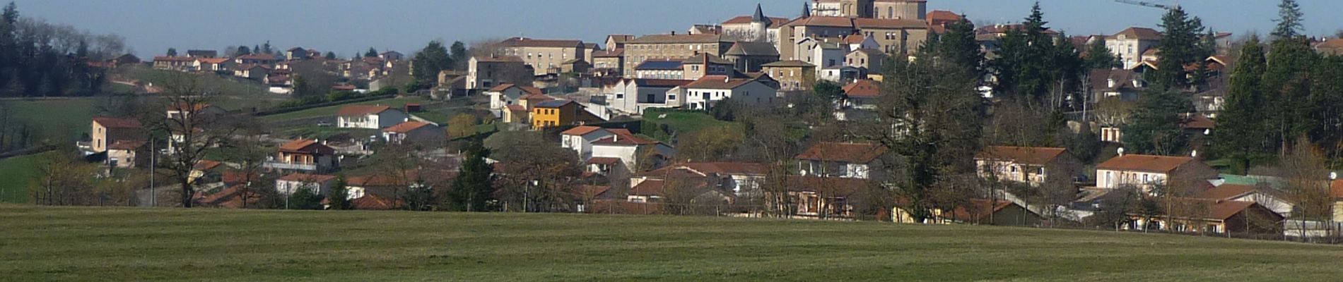
Trail Walking of 12.1 km to be discovered at Auvergne-Rhône-Alpes, Loire, Saint-Symphorien-de-Lay. This trail is proposed by jpc42.

Description

Circuit Copler n° 28

Elevation profile

Photos

Positioning

Country:
France
Region :
Auvergne-Rhône-Alpes
Department/Province :
Loire
Municipality :
Saint-Symphorien-de-Lay
Location:
Unknown
Start:(UTM)
593792 ; 5088960 (31T) N.

Trails nearby

Trail Walking Saint-Symphorien-de-Lay - etang st symphorien de lay - Photo
Walking
poterie

Walking

Difficult
(1)
Saint-Symphorien-de-Lay, Auvergne-Rhône-Alpes, Loire, France
10.6 km | 14.5 km-effort
3h 17min
Yes
Trail Walking Saint-Symphorien-de-Lay - St Symphorien de lay, agri rando - Photo
Walking
mimi69670

Walking

Easy
Saint-Symphorien-de-Lay, Auvergne-Rhône-Alpes, Loire, France
15.6 km | 21 km-effort
4h 6min
No
Trail Walking Saint-Symphorien-de-Lay - St Symphorien de Lay - Photo
Walking
jpc42

Walking

Medium
Saint-Symphorien-de-Lay, Auvergne-Rhône-Alpes, Loire, France
10.5 km | 14.4 km-effort
3h 3min
Yes
Trail Mountain bike Fourneaux - Rando VTT des Crêtes (2014-VTT-50km) - Fourneaux - Photo
Mountain bike
tracegps

Mountain bike

Very difficult
Fourneaux, Auvergne-Rhône-Alpes, Loire, France
48 km | 67 km-effort
4h 30min
Yes
Trail Mountain bike Saint-Symphorien-de-Lay - VTT au creux des Vallées du Gand de l''Ecoron et du Rhins - Saint-Symphorien-de-Lay - Photo
Mountain bike
tracegps

Mountain bike

Difficult
Saint-Symphorien-de-Lay, Auvergne-Rhône-Alpes, Loire, France
30 km | 38 km-effort
3h 0min
Yes
Trail Running Neaux - La route Napoléon et la Vallée du Gand à VTT - Neaux - Photo
Running
tracegps

Running

Medium
Neaux, Auvergne-Rhône-Alpes, Loire, France
11.7 km | 14.7 km-effort
2h 0min
Yes
Trail Mountain bike Neaux - La route Napoléon et la Vallée du Gand à VTT - Neaux - Photo
Mountain bike
tracegps

Mountain bike

Medium
Neaux, Auvergne-Rhône-Alpes, Loire, France
11.7 km | 14.7 km-effort
1h 15min
Yes
Trail Walking Neaux - La route Napoléon et la Vallée du Gand à VTT - Neaux - Photo
Walking
tracegps

Walking

Medium
Neaux, Auvergne-Rhône-Alpes, Loire, France
11.7 km | 14.7 km-effort
3h 0min
Yes
Trail Mountain bike Fourneaux - Rando VTT des Crêtes (2013-VTT-50km) - Fourneaux - Photo
Mountain bike
tracegps

Mountain bike

Very difficult
Fourneaux, Auvergne-Rhône-Alpes, Loire, France
51 km | 71 km-effort
5h 0min
Yes


Close
My subscriptions