


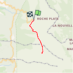
Du maido à la glacière ( aller retour )

nicolasdresse
User


3h03
Difficulty : Difficult

FREE GPS app for hiking
 SityTrail
IGN / Geographical institutes
SityTrail Plus
The world is yours!
About
Trail Walking of 11.9 km to be discovered at Réunion, Unknown, Saint-Paul. This trail is proposed by nicolasdresse.
Description
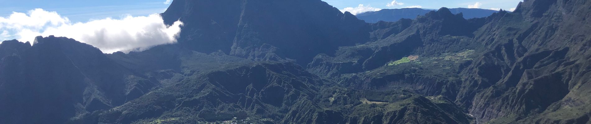
Belle balade avec quand même un dénivelé positif conséquent pour qui n est pas habitué à la marche en “ montagne “. Glacière avec un certain intérêt historique. Prévoir de partir avant 9.00 si on ne veut pas se prendre la brûle
Photos
 - Photo 1")
 - Photo 2")
 - Photo 3")
 - Photo 4")
 - Photo 5")
 - Photo 6")
 - Photo 7")
 - Photo 8")
 - Photo 9")
 - Photo 10")
Positioning
Comments