


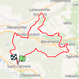
sortie vtt du 03032019 fremenil

fabwin
User GUIDE


2h35
Difficulty : Medium

FREE GPS app for hiking
 SityTrail
IGN / Geographical institutes
SityTrail Plus
The world is yours!
About
Trail Mountain bike of 40 km to be discovered at Grand Est, Meurthe-et-Moselle, Saint-Clément. This trail is proposed by fabwin.
Description
Une sortie sympathique avec le vent en invité.
départ à 8h46 précise (merci David!!) pour 40km.
La terre grasse a été de la partie et on a bien cru se retrouver bloqué tellement les roues, les dérailleurs étaient pleins de terre. Mais ce n'est pas cela qui nous arrête!!!!
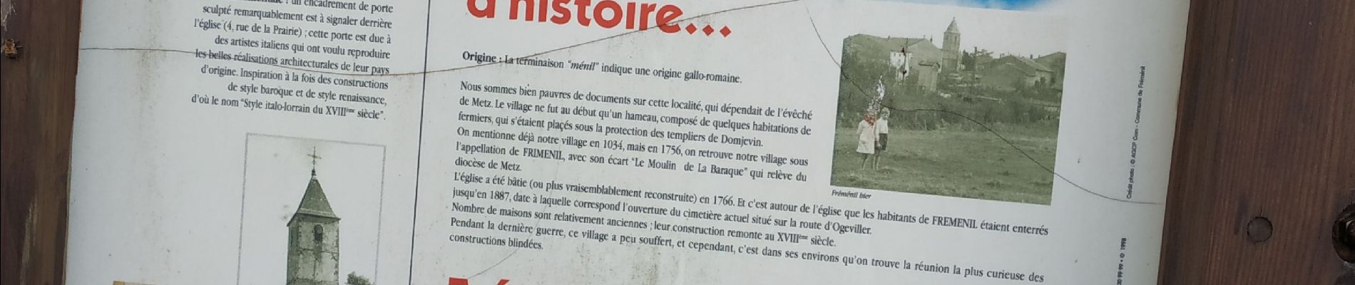
On a eu le plaisir de voir 3 chevreuils en liberté puis d'en caresser à l'enclos de Thiébauménil.
Photos


Positioning
Comments