Trail On foot Eyguières - Le Mont Menu - Photo
 morthy25
morthy25

User

© OpenStreetMap contributors
Length
Length
6.1 km
Max alt
Max alt
224 m
Uphill gradient
Uphill gradient
144 m
Km-Effort
Km-Effort  
8.1 km
Min alt
Min alt
97 m
Downhill gradient
Downhill gradient
144 m
Boucle
Boucle
Yes
Creation date :
2019-03-03 11:05:52.0
Updated on :
2019-03-03 17:20:11.494

(0 Reviews)

On foot
On foot
2h00
Difficulty : Easy

Scan this QR Code to open this trail in the SityTrail application

FREE GPS app for hiking

Logo SityTrail SityTrail

IGN / Geographical institutes

Download SityTrail from the App Store Download SityTrail from Google Play

Logo SityTrail SityTrail World

The world is yours!

Download SityTrail from the App Store Download SityTrail from Google Play Download SityTrail on Huawei AppGallery

About

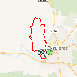
Trail On foot of 6.1 km to be discovered at Provence-Alpes-Côte d'Azur, Bouches-du-Rhône, Eyguières. This trail is proposed by morthy25.

Description

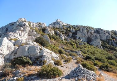
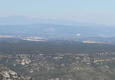
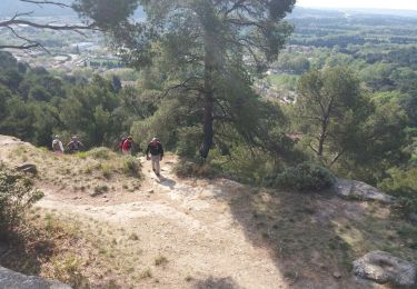
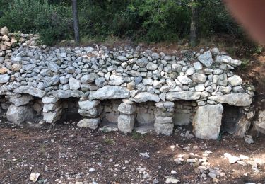
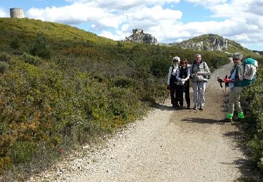
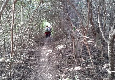
Promenade sur le Mont Menu, en dehors des sentiers battus.
Attention, ni jupe, ni short ! Les chênes Kermesses sont redoutables.

Elevation profile

Photos

Positioning

Country:
France
Region :
Provence-Alpes-Côte d'Azur
Department/Province :
Bouches-du-Rhône
Municipality :
Eyguières
Location:
Unknown
Start:(UTM)
663007 ; 4839488 (31T) N.

Trails nearby

Trail Walking Lamanon - lamanon grottes calas - Photo
Walking
vorthex

Walking

Very easy
(1)
Lamanon, Provence-Alpes-Côte d'Azur, Bouches-du-Rhône, France
9.7 km | 13 km-effort
2h 38min
No
Trail Walking Eyguières - La Tour des Opies - Photo
Walking
HaschKnight

Walking

Difficult
Eyguières, Provence-Alpes-Côte d'Azur, Bouches-du-Rhône, France
11.6 km | 16.9 km-effort
3h 33min
Yes
Trail Walking Lamanon - Lamanon Cales Facile - Photo
Walking
hervef13300

Walking

Easy
(1)
Lamanon, Provence-Alpes-Côte d'Azur, Bouches-du-Rhône, France
6.2 km | 8.9 km-effort
1h 30min
Yes
Trail Walking Eyguières - Tour des Opies par les Barres Rouges - Photo
Walking
counoise

Walking

Medium
Eyguières, Provence-Alpes-Côte d'Azur, Bouches-du-Rhône, France
8.8 km | 14.1 km-effort
2h 52min
Yes
Trail Walking Lamanon - lamanon - Photo
Walking
esperandieu

Walking

Medium
Lamanon, Provence-Alpes-Côte d'Azur, Bouches-du-Rhône, France
14.3 km | 19.4 km-effort
6h 18min
Yes
Trail Walking Lamanon - PF-Lamanon - Le Mur aux Abeilles - Photo
Walking
MicDul

Walking

Medium
Lamanon, Provence-Alpes-Côte d'Azur, Bouches-du-Rhône, France
6.5 km | 9.1 km-effort
2h 23min
Yes
Trail Walking Eyguières - eyguiers - Photo
Walking
jo-ba

Walking

Easy
Eyguières, Provence-Alpes-Côte d'Azur, Bouches-du-Rhône, France
14.3 km | 17.6 km-effort
5h 10min
Yes
Trail Walking Eyguières - eyguieres - Photo
Walking
jo-ba

Walking

Very easy
Eyguières, Provence-Alpes-Côte d'Azur, Bouches-du-Rhône, France
15.2 km | 19.5 km-effort
5h 50min
Yes
Trail Walking Eyguières - PF-Eyguières - Le Vallon des Glauges - Photo
Walking
MicDul

Walking

Very easy
Eyguières, Provence-Alpes-Côte d'Azur, Bouches-du-Rhône, France
8.4 km | 9.6 km-effort
2h 9min
Yes


Close
My subscriptions