


Apchat_3_Vallees

jagarnier
User GUIDE
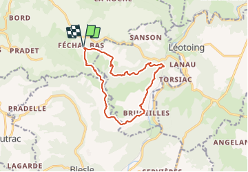

Length
12.4 km

Max alt
681 m

Uphill gradient
451 m
Km-Effort
18.4 km

Min alt
481 m

Downhill gradient
451 m
Boucle
Yes
Creation date :
2019-03-12 10:05:07.582
Updated on :
2023-11-15 10:03:13.674
3h45
Difficulty : Medium

FREE GPS app for hiking
 SityTrail
IGN / Geographical institutes
SityTrail Plus
The world is yours!
About
Trail Walking of 12.4 km to be discovered at Auvergne-Rhône-Alpes, Puy-de-Dôme, Apchat. This trail is proposed by jagarnier.
Description
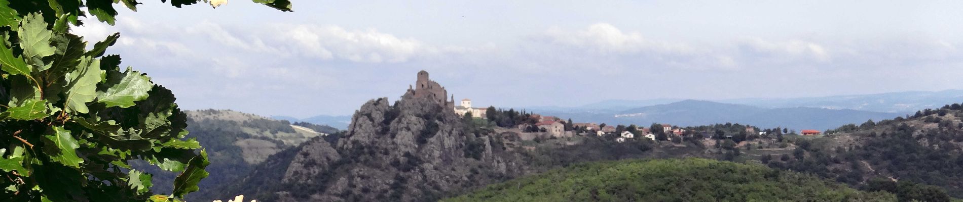
Des chemins pour surprendre au delà de l'Alagnon, la forteresse de Léotoing et les vallées de l'Auze et de la Bave. Un hors circuit est conseillé vers le village de Bousselargues et son église.
Photos

Positioning
Country:
France
Region :
Auvergne-Rhône-Alpes
Department/Province :
Puy-de-Dôme
Municipality :
Apchat
Location:
Unknown
Start:(Dec)
Start:(UTM)
513355 ; 5023188 (31T) N.
Comments