


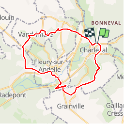
20190312 Charleval Vandrimare

Childebert
User

Length
14.4 km

Max alt
139 m

Uphill gradient
283 m
Km-Effort
18.2 km

Min alt
28 m

Downhill gradient
283 m
Boucle
Yes
Creation date :
2019-03-12 14:01:47.981
Updated on :
2019-03-12 20:28:17.408
3h39
Difficulty : Medium

FREE GPS app for hiking
 SityTrail
IGN / Geographical institutes
SityTrail Plus
The world is yours!
About
Trail Walking of 14.4 km to be discovered at Normandy, Eure, Charleval. This trail is proposed by Childebert.
Positioning
Country:
France
Region :
Normandy
Department/Province :
Eure
Municipality :
Charleval
Location:
Unknown
Start:(Dec)
Start:(UTM)
382853 ; 5470388 (31U) N.
Comments