


SteleTableSh

pythonmichel
User
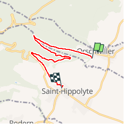

Length
5.7 km

Max alt
462 m

Uphill gradient
209 m
Km-Effort
8.5 km

Min alt
249 m

Downhill gradient
229 m
Boucle
No
Creation date :
2019-03-25 09:01:54.565
Updated on :
2019-03-25 16:32:00.952
1h37
Difficulty : Medium

FREE GPS app for hiking
 SityTrail
IGN / Geographical institutes
SityTrail Plus
The world is yours!
About
Trail Walking of 5.7 km to be discovered at Grand Est, Bas-Rhin, Orschwiller. This trail is proposed by pythonmichel.
Positioning
Country:
France
Region :
Grand Est
Department/Province :
Bas-Rhin
Municipality :
Orschwiller
Location:
Unknown
Start:(Dec)
Start:(UTM)
379628 ; 5344292 (32U) N.
Comments