


Clamouse - Saint Guilhem le Désert - Cap Ginestet

vertygo
User
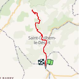

Length
16.6 km

Max alt
540 m

Uphill gradient
548 m
Km-Effort
24 km

Min alt
58 m

Downhill gradient
545 m
Boucle
Yes
Creation date :
2019-03-26 08:50:33.556
Updated on :
2019-06-26 17:57:44.522
4h34
Difficulty : Medium

FREE GPS app for hiking
 SityTrail
IGN / Geographical institutes
SityTrail Plus
The world is yours!
About
Trail Walking of 16.6 km to be discovered at Occitania, Hérault, Saint-Jean-de-Fos. This trail is proposed by vertygo.
Photos

Positioning
Country:
France
Region :
Occitania
Department/Province :
Hérault
Municipality :
Saint-Jean-de-Fos
Location:
Unknown
Start:(Dec)
Start:(UTM)
544529 ; 4839901 (31T) N.
Comments