


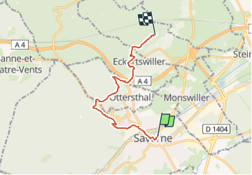
Reinhardsmunster - Ochsenstein

RUHLMANN
User

Length
8.7 km

Max alt
401 m

Uphill gradient
411 m
Km-Effort
13.6 km

Min alt
185 m

Downhill gradient
223 m
Boucle
No
Creation date :
2019-03-27 09:12:35.882
Updated on :
2025-08-09 08:31:50.664
3h05
Difficulty : Difficult

FREE GPS app for hiking
 SityTrail
IGN / Geographical institutes
SityTrail Plus
The world is yours!
About
Trail Walking of 8.7 km to be discovered at Grand Est, Bas-Rhin, Saverne. This trail is proposed by RUHLMANN.
Positioning
Country:
France
Region :
Grand Est
Department/Province :
Bas-Rhin
Municipality :
Saverne
Location:
Unknown
Start:(Dec)
Start:(UTM)
379806 ; 5400156 (32U) N.
Comments