Trail Mountain bike Saint-Dié-des-Vosges - vtt la voivre La Bure 29-03-19 - Photo

vtt la voivre La Bure 29-03-19

 vathi54
vathi54

User

© OpenStreetMap contributors
Length
Length
20 km
Max alt
Max alt
660 m
Uphill gradient
Uphill gradient
575 m
Km-Effort
Km-Effort  
28 km
Min alt
Min alt
314 m
Downhill gradient
Downhill gradient
576 m
Boucle
Boucle
Yes
Creation date :
2019-03-29 13:55:03.498
Updated on :
2019-03-29 20:05:19.303

(2 Reviews)

Mountain bike
Mountain bike
2h48
Difficulty : Difficult

Scan this QR Code to open this trail in the SityTrail application

FREE GPS app for hiking

Logo SityTrail SityTrail

IGN / Geographical institutes

Download SityTrail from the App Store Download SityTrail from Google Play

Logo SityTrail SityTrail Plus

The world is yours!

Download SityTrail from the App Store Download SityTrail from Google Play Download SityTrail on Huawei AppGallery

About

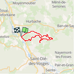
Trail Mountain bike of 20 km to be discovered at Grand Est, Vosges, Saint-Dié-des-Vosges. This trail is proposed by vathi54.

Description

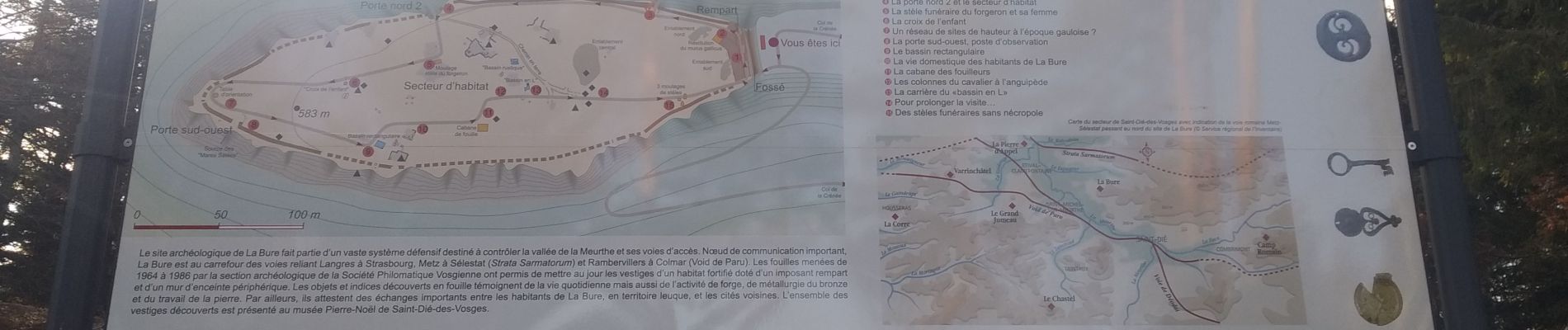
Parcours varié, chemins forestiers, singles roulants et techniques avec un peu de portage autour du camp celtique de la Bure et point de vue à la Roche des Corbeaux

Elevation profile

Photos

28 photos in total. Please click on a photo to see them all in the gallery.

Positioning

Country:
France
Region :
Grand Est
Department/Province :
Vosges
Municipality :
Saint-Dié-des-Vosges
Location:
Unknown
Start:(UTM)
344819 ; 5354678 (32U) N.

Comments

Please log in to post a review or rate the element


chemins non entretenus


Close
My subscriptions