


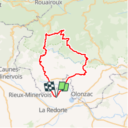
azille Minerve le bouis ferrals azille

F.Rioland
User

Length
53 km

Max alt
607 m

Uphill gradient
981 m
Km-Effort
66 km

Min alt
69 m

Downhill gradient
981 m
Boucle
Yes
Creation date :
2019-03-31 10:03:35.339
Updated on :
2019-06-15 17:51:35.198
4h09
Difficulty : Medium

FREE GPS app for hiking
 SityTrail
IGN / Geographical institutes
SityTrail Plus
The world is yours!
About
Trail Road bike of 53 km to be discovered at Occitania, Aude, Azille. This trail is proposed by F.Rioland.
Positioning
Country:
France
Region :
Occitania
Department/Province :
Aude
Municipality :
Azille
Location:
Unknown
Start:(Dec)
Start:(UTM)
472494 ; 4791669 (31T) N.
Comments