


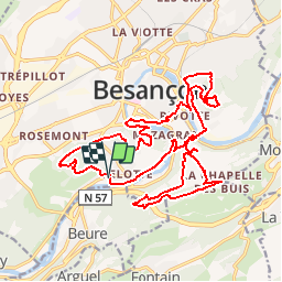
Les Forts de Besançon

tiene
User

Length
24 km

Max alt
495 m

Uphill gradient
1002 m
Km-Effort
38 km

Min alt
233 m

Downhill gradient
1005 m
Boucle
Yes
Creation date :
2019-04-04 14:57:30.353
Updated on :
2019-04-04 15:02:12.593
7h50
Difficulty : Very difficult

FREE GPS app for hiking
 SityTrail
IGN / Geographical institutes
SityTrail Plus
The world is yours!
About
Trail Walking of 24 km to be discovered at Bourgogne-Franche-Comté, Doubs, Besançon. This trail is proposed by tiene.
Positioning
Country:
France
Region :
Bourgogne-Franche-Comté
Department/Province :
Doubs
Municipality :
Besançon
Location:
Unknown
Start:(Dec)
Start:(UTM)
273729 ; 5233851 (32T) N.
Comments