


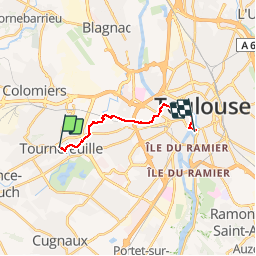
TT-Tournefeuille-Lardenne

zazibelle
User

Length
12.1 km

Max alt
159 m

Uphill gradient
113 m
Km-Effort
13.7 km

Min alt
126 m

Downhill gradient
129 m
Boucle
No
Creation date :
2019-04-04 20:48:13.904
Updated on :
2019-04-04 20:48:37.482
3h00
Difficulty : Difficult

FREE GPS app for hiking
 SityTrail
IGN / Geographical institutes
SityTrail Plus
The world is yours!
About
Trail Walking of 12.1 km to be discovered at Occitania, Haute-Garonne, Tournefeuille. This trail is proposed by zazibelle.
Positioning
Country:
France
Region :
Occitania
Department/Province :
Haute-Garonne
Municipality :
Tournefeuille
Location:
Unknown
Start:(Dec)
Start:(UTM)
366494 ; 4826944 (31T) N.
Comments