


Plateau St Marc Jaumegarde

mhetpierre
User
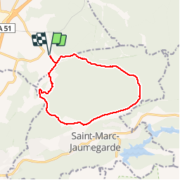

Length
12.9 km

Max alt
511 m

Uphill gradient
209 m
Km-Effort
15.7 km

Min alt
352 m

Downhill gradient
209 m
Boucle
Yes
Creation date :
2019-04-05 07:35:37.674
Updated on :
2019-04-07 16:59:15.589
3h25
Difficulty : Difficult

FREE GPS app for hiking
 SityTrail
IGN / Geographical institutes
SityTrail Plus
The world is yours!
About
Trail Walking of 12.9 km to be discovered at Provence-Alpes-Côte d'Azur, Bouches-du-Rhône, Venelles. This trail is proposed by mhetpierre.
Positioning
Country:
France
Region :
Provence-Alpes-Côte d'Azur
Department/Province :
Bouches-du-Rhône
Municipality :
Venelles
Location:
Unknown
Start:(Dec)
Start:(UTM)
701888 ; 4828041 (31T) N.
Comments