Trail Walking Belsentes - Nonières. Par les chemins de l'école Buisson-nière - Photo

Nonières. Par les chemins de l'école Buisson-nière

© OpenStreetMap contributors
Length
Length
8.6 km
Max alt
Max alt
910 m
Uphill gradient
Uphill gradient
419 m
Km-Effort
Km-Effort  
14.2 km
Min alt
Min alt
590 m
Downhill gradient
Downhill gradient
420 m
Boucle
Boucle
Yes
Creation date :
2019-04-06 06:48:49.614
Updated on :
2019-04-16 13:16:30.15

(0 Reviews)

Walking
Walking
3h20
Difficulty : Medium

Scan this QR Code to open this trail in the SityTrail application

FREE GPS app for hiking

Logo SityTrail SityTrail

IGN / Geographical institutes

Download SityTrail from the App Store Download SityTrail from Google Play

Logo SityTrail SityTrail World

The world is yours!

Download SityTrail from the App Store Download SityTrail from Google Play Download SityTrail on Huawei AppGallery

About

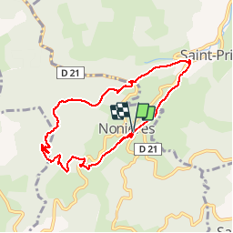
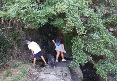
Trail Walking of 8.6 km to be discovered at Auvergne-Rhône-Alpes, Ardèche, Belsentes. This trail is proposed by bernadette revoux.

Description

9km  420 m de dénivelé
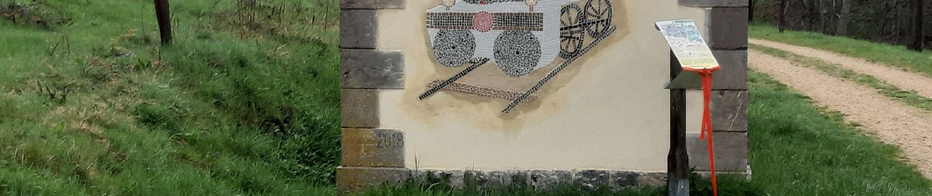
il pleuvait !
La marche n'a duré que 2h environ. Le tracé a continué à être enregistré pendant le casse-croute et le retour sur Lamastre en voiture ce qui explique les 3h20

Elevation profile

Photos

Positioning

Country:
France
Region :
Auvergne-Rhône-Alpes
Department/Province :
Ardèche
Municipality :
Belsentes
Location:
Nonières
Start:(UTM)
617325 ; 4976522 (31T) N.

Trails nearby

Trail Walking Belsentes - Autour de la Chazalet  - Photo
Walking
GUIDE
nadinebondoux

Walking

Easy
(1)
Belsentes, Auvergne-Rhône-Alpes, Ardèche, France
8.1 km | 11.5 km-effort
2h 18min
Yes
Trail Walking Saint-Jean-Chambre - Boucle Chalencon Pont de Chervil - Photo
Walking
GUIDE
nadinebondoux

Walking

Difficult
Saint-Jean-Chambre, Auvergne-Rhône-Alpes, Ardèche, France
15.9 km | 24 km-effort
5h 42min
Yes
Trail Walking Belsentes - Saint-julien-labrousse 1er mai la rando des chanteurs de mai - Photo
Walking
bernadette revoux

Walking

Medium
Belsentes, Auvergne-Rhône-Alpes, Ardèche, France
20 km | 30 km-effort
4h 35min
No
Trail Walking Le Cheylard - Randonnée Le cheylard - Saint-Agrève - Lac Devesset - Photo
Walking
voyageur_nature

Walking

Medium
(2)
Le Cheylard, Auvergne-Rhône-Alpes, Ardèche, France
34 km | 45 km-effort
9h 55min
No
Trail Walking Le Cheylard - Le Cheylard -> Saint Martin de Valamas - Photo
Walking
voyageur_nature

Walking

Very easy
Le Cheylard, Auvergne-Rhône-Alpes, Ardèche, France
17.4 km | 22 km-effort
5h 9min
Yes
Trail Mountain bike Belsentes - St Julien Boutières - La Gare- Le Cheylard - Photo
Mountain bike
tracegps

Mountain bike

Medium
Belsentes, Auvergne-Rhône-Alpes, Ardèche, France
35 km | 43 km-effort
2h 30min
Yes
Trail Road bike Saint-Prix - 07 vélo st agreve Cheylard desaigne - Photo
Road bike
himba26100

Road bike

Medium
Saint-Prix, Auvergne-Rhône-Alpes, Ardèche, France
66 km | 87 km-effort
6h 53min
Yes
Trail Horseback riding Saint-Prix - SityTrail - J5 Ardèche jeudi 8 juin 2023 - Photo
Horseback riding
GUIDE
holtzv

Horseback riding

Medium
Saint-Prix, Auvergne-Rhône-Alpes, Ardèche, France
27 km | 38 km-effort
5h 2min
No
Trail Walking Le Cheylard - Cheylard3 - Photo
Walking
hduchamp

Walking

Difficult
Le Cheylard, Auvergne-Rhône-Alpes, Ardèche, France
9.1 km | 13.7 km-effort
2h 48min
No


Close
My subscriptions