


L'éolienne

selmak
User

Length
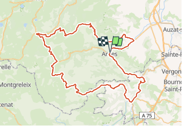
101 km

Max alt
1317 m

Uphill gradient
2149 m
Km-Effort
130 km

Min alt
461 m

Downhill gradient
2161 m
Boucle
Yes
Creation date :
2014-12-10 00:00:00.0
Updated on :
2014-12-10 00:00:00.0
7h23
Difficulty : Difficult

FREE GPS app for hiking
 SityTrail
IGN / Geographical institutes
SityTrail Plus
The world is yours!
About
Trail Cycle of 101 km to be discovered at Auvergne-Rhône-Alpes, Puy-de-Dôme, Ardes. This trail is proposed by selmak.
Description
Cyclosportive Ardes sur Couze
Circuit moyen
Positioning
Country:
France
Region :
Auvergne-Rhône-Alpes
Department/Province :
Puy-de-Dôme
Municipality :
Ardes
Location:
Unknown
Start:(Dec)
Start:(UTM)
510029 ; 5028050 (31T) N.
Comments