


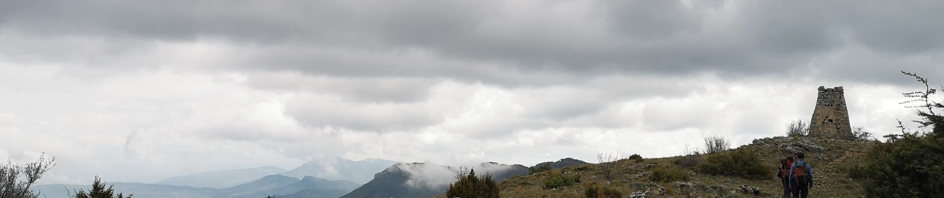
Signes le Mourre d'Agnis

bernir
User
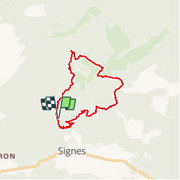

Length
13.2 km

Max alt
910 m

Uphill gradient
555 m
Km-Effort
21 km

Min alt
416 m

Downhill gradient
560 m
Boucle
Yes
Creation date :
2019-04-12 07:18:46.378
Updated on :
2019-04-14 09:58:23.196
5h52
Difficulty : Medium

FREE GPS app for hiking
 SityTrail
IGN / Geographical institutes
SityTrail Plus
The world is yours!
About
Trail Walking of 13.2 km to be discovered at Provence-Alpes-Côte d'Azur, Var, Signes. This trail is proposed by bernir.
Photos

Positioning
Country:
France
Region :
Provence-Alpes-Côte d'Azur
Department/Province :
Var
Municipality :
Signes
Location:
Unknown
Start:(Dec)
Start:(UTM)
731747 ; 4798340 (31T) N.
Comments