


risoul route de vars par en bas

laet
User
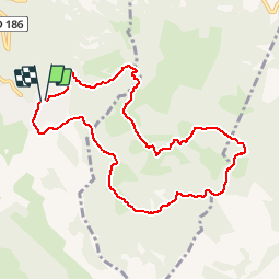

Length
9.5 km

Max alt
2066 m

Uphill gradient
361 m
Km-Effort
14.3 km

Min alt
1750 m

Downhill gradient
358 m
Boucle
Yes
Creation date :
2019-05-26 16:15:51.589
Updated on :
2019-05-26 16:15:51.856
1h01
Difficulty : Medium

FREE GPS app for hiking
 SityTrail
IGN / Geographical institutes
SityTrail Plus
The world is yours!
About
Trail Running of 9.5 km to be discovered at Provence-Alpes-Côte d'Azur, Hautes-Alpes, Risoul. This trail is proposed by laet.
Positioning
Country:
France
Region :
Provence-Alpes-Côte d'Azur
Department/Province :
Hautes-Alpes
Municipality :
Risoul
Location:
Unknown
Start:(Dec)
Start:(UTM)
312443 ; 4943822 (32T) N.
Comments