


St_Ours_Autour_Puys

jagarnier
User GUIDE
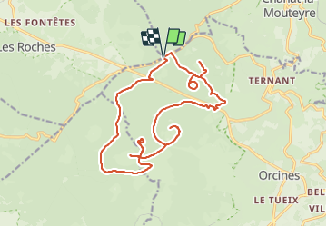

Length
21 km

Max alt
1220 m

Uphill gradient
830 m
Km-Effort
32 km

Min alt
954 m

Downhill gradient
830 m
Boucle
Yes
Creation date :
2019-04-14 05:58:34.433
Updated on :
2023-10-17 09:50:54.382
6h30
Difficulty : Difficult

FREE GPS app for hiking
 SityTrail
IGN / Geographical institutes
SityTrail Plus
The world is yours!
About
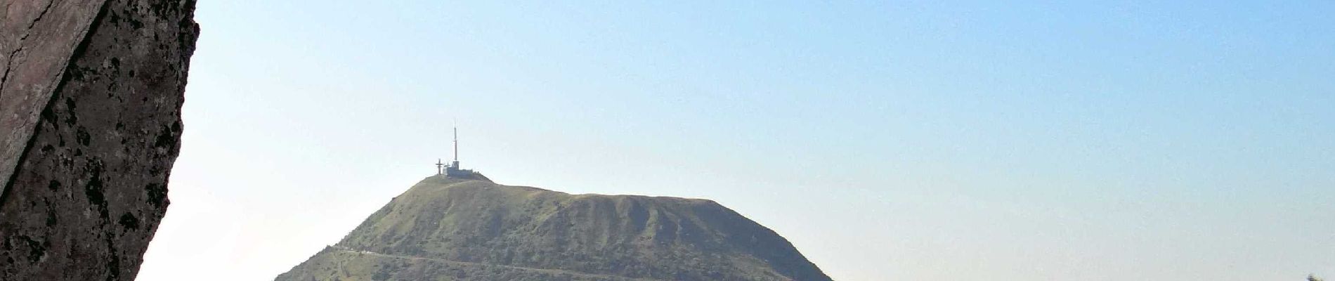
Trail Walking of 21 km to be discovered at Auvergne-Rhône-Alpes, Puy-de-Dôme, Orcines. This trail is proposed by jagarnier.
Photos

Positioning
Country:
France
Region :
Auvergne-Rhône-Alpes
Department/Province :
Puy-de-Dôme
Municipality :
Orcines
Location:
Unknown
Start:(Dec)
Start:(UTM)
497502 ; 5073637 (31T) N.
Comments