


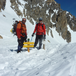
par Lago Verde
DC2019
dernière ligne droite?
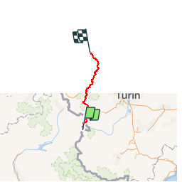

Length
215 km

Max alt
3065 m

Uphill gradient
15428 m
Km-Effort
423 km

Min alt
492 m

Downhill gradient
16125 m
Boucle
No
Creation date :
2019-04-17 14:55:13.784
Updated on :
2019-04-17 15:09:40.312

FREE GPS app for hiking
 SityTrail
IGN / Geographical institutes
SityTrail Plus
The world is yours!
About
Trail of 215 km to be discovered at Provence-Alpes-Côte d'Azur, Hautes-Alpes, Molines-en-Queyras. This trail is proposed by DC2019.
Positioning
Country:
France
Region :
Provence-Alpes-Côte d'Azur
Department/Province :
Hautes-Alpes
Municipality :
Molines-en-Queyras
Location:
Unknown
Start:(Dec)
Start:(UTM)
339616 ; 4950531 (32T) N.
Comments