


ottrott-dreistein

anniston
User
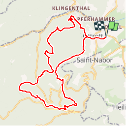

Length
22 km

Max alt
834 m

Uphill gradient
777 m
Km-Effort
32 km

Min alt
262 m

Downhill gradient
777 m
Boucle
Yes
Creation date :
2019-04-17 22:42:56.943
Updated on :
2019-04-17 23:29:39.442
3h53
Difficulty : Medium

FREE GPS app for hiking
 SityTrail
IGN / Geographical institutes
SityTrail Plus
The world is yours!
About
Trail Horseback riding of 22 km to be discovered at Grand Est, Bas-Rhin, Ottrott. This trail is proposed by anniston.
Positioning
Country:
France
Region :
Grand Est
Department/Province :
Bas-Rhin
Municipality :
Ottrott
Location:
Unknown
Start:(Dec)
Start:(UTM)
384091 ; 5368215 (32U) N.
Comments