


CABASSE BON

Sugg
User
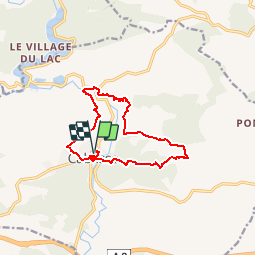

Length
12.7 km

Max alt
339 m

Uphill gradient
460 m
Km-Effort
18.8 km

Min alt
188 m

Downhill gradient
460 m
Boucle
Yes
Creation date :
2019-04-20 17:08:37.273
Updated on :
2019-04-20 17:37:52.555
3h56
Difficulty : Difficult

FREE GPS app for hiking
 SityTrail
IGN / Geographical institutes
SityTrail Plus
The world is yours!
About
Trail Walking of 12.7 km to be discovered at Provence-Alpes-Côte d'Azur, Var, Cabasse. This trail is proposed by Sugg.
Description
Projet de Pierre pour une rando à Cabasse prévue le 24 avril 2019
Positioning
Country:
France
Region :
Provence-Alpes-Côte d'Azur
Department/Province :
Var
Municipality :
Cabasse
Location:
Unknown
Start:(Dec)
Start:(UTM)
275181 ; 4812033 (32T) N.
Comments