


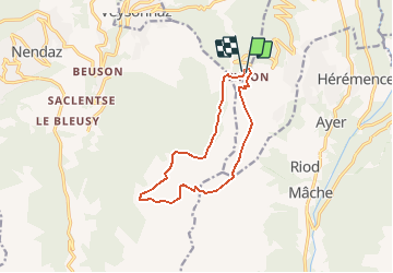

10.1 km | 13.2 km-effort


User


FREE GPS app for hiking
 SityTrail
IGN / Geographical institutes
SityTrail World
The world is yours!
Trail Walking of 11.3 km to be discovered at Valais/Wallis, Sion, Sion. This trail is proposed by duamerg.
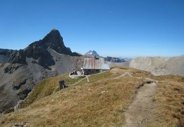
Laisser la voiture à Thyon et monter vers l'arrivée des téléphériques. Prendre la direction de la Combire (restaurant en saison) puis poursuivre jusqu'à Meitia. Prendre l'indication Greppon Blanc, à travers champs monter jusque sous le départ d'un télésiège. Partir sur la gauche sur une piste de ski en hiver. Un chemin part sur la droite et monte jusqu'au Mont Rouge. Deux variantes possibles, le retour la les crêtes ou rejoindre les Gouilles pour un pic nic bien mérité. A Thyon ne manquez pas les 2 tables d'orientations pour donner un nom à plus de 70 sommets!!
Ballade de difficulté moyenne, pas très bien marqué dans la première partie qui va au Mont Rouge. A nouveau une vue pas possible, à vos jumelles.
On foot
On foot
On foot
Walking
Nordic walking
Walking

Other activity

Mountain bike

Walking
Nickel randonnée un peu modifiée.